istock 15% OFF Exclusive Promo Code for Photos, Vectors and Video (Code: StockEditor15)

Sponsored Images iStock LIMITED DEAL:15% off with StockEditor15 coupon

satellite top view photography of landscape geographical

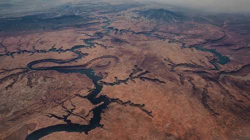
Aerial View of Unique Geographical Landscape Featuring Striking Brown and Black Rock Patterns

landscape aerial photo of brown mountain during daytime outdoors

Breathtaking Aerial View of Brown Mountains Under Clear Daylight landscape daytime

landscape aerial photography of mountain ridge wallpaper

Breathtaking Aerial View of Mountain Ridge - Perfect Wallpaper

Landscape of roads and hills on New Zealand image - Free

Breathtaking New Zealand Landscape: Roads and Hills Mapping the Island landscape roads

High Mountains near the India-China Border landscape image

Breathtaking Mountain Range Landscape Near India-China Border

Koganesaki Beach landscape in Japan image - Free

Koganesaki Beach Landscape in Japan - Serene Rocky Shore Japan nature

Landscape of the Rio Grande at Boquilla Del Carmen

Breathtaking Landscape of the Rio Grande at Boquilla Del Carmen eco-tourism wilderness

landscape aerial photography of mountain ranges mountains

Aerial Shot of Sahara Mountain Ranges landscape travel

landscape aerial photo of brown mountains and river river

Breathtaking Aerial View of Brown Mountains and the Nile Delta

the dead sea bird's eye view of sea sea

Aerial Wonders of the Dead Sea: Bird's Eye View

israel aerial view of city buildings near body of water during daytime high rise

Aerial View of Haifa: Cityscape, Sea, and Mountains

desert bird's eye photography of road on dessert jordan valley

Aerial View of Desert Road in Jordan Valley

nature  dead sea

Breathtaking Aerial View of the Dead Sea from Mountain Summit

grey assorted-colored miniature flag on political map iceland

Colorful Miniature Flags on Iceland Political Map for Travel and Education

east coast Geographical map sketch old

Vintage East Coast Geographical Map with Soft Light Illumination

texture map illustration red river gorge

Vintage Texture Map Illustration of Red River Gorge

grey aerial photo of island antelope island

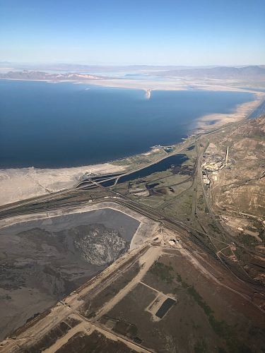
Aerial View of Antelope Island - Santo Island

grey aerial photography of mountain mountain range

Grey Aerial View of Mountain Range

desktop wallpapers brown desert on top view drone view

Aerial Desert Landscape: Brown Desert and Nile River Views in Egypt

new zealand grey and brown stone water

Coastal Cliffs of New Zealand with Grey and Brown Stone Waters

landsat aerial photography of islands abstract

Aerial View of Abstract Islands with Blue Lake from Space

  line  asia  japan  map  creativecommons

Detailed Map of Tokyo: A Creative Commons Visual Guide

The Canyons Aerial View

Aerial View of Canyons from Space

  night  atmosphere  ice  arctic  moonlight

Enchanting Arctic Night: Moonlit World Map in Icy Serenity

  sand  snow  white  desert  river  aerial

Breathtaking Aerial View of the White Desert and Nile Delta

Satellite view of the Auckland isthmus and Waitemata

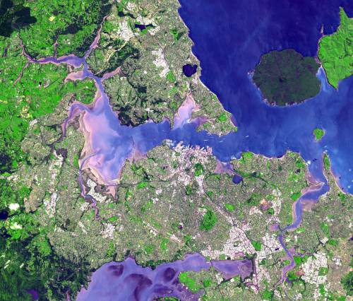
Satellite View of Auckland Isthmus and Waitemata from Space

Satellite Image of Japan image - Freephoto - Public

Satellite Image of Japan: Aerial View from Space

False-color satellite image of El Paso, Texas image - Free

False-Color Satellite Image of El Paso, Texas

Satellite Image of Boise, Idaho image - Freephoto

Aerial Satellite View of Boise, Idaho

Satellite View of Cape Cod, Massachusetts image - Free

Captivating Satellite View of Cape Cod, Massachusetts - A Scenic Aerial Perspective

Satellite Image of the Los Angeles Basin, California image

Satellite Image of the Icy Los Angeles Basin

sahara desert blue and brown satellite illustration geographical

Satellite View of the Sahara Desert: Blue and Brown Abstract Landscape

namibia aerial photo of island aerial

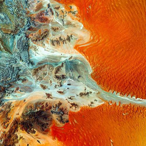
Aerial View of Namibia's Islands: An Orange and Blue Wonder

alexander lake aerial photography of land mass during daytime brown

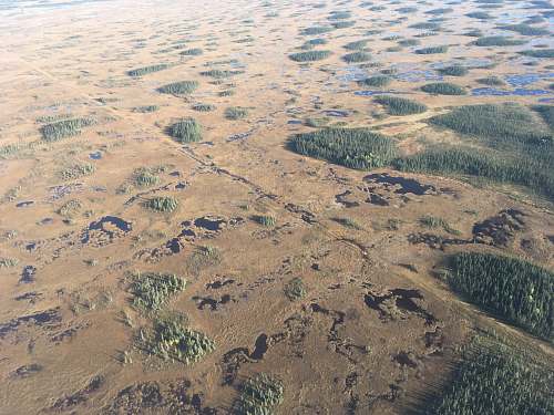
Aerial View of Alexander Lake: A Brown Land Mass Captured in Daylight

nature gray mountain outdoors

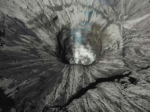
Gray Mountain Crater: Nature's Breathtaking Landscape

mountain yellow and black signage at mountain covered with snow outdoors

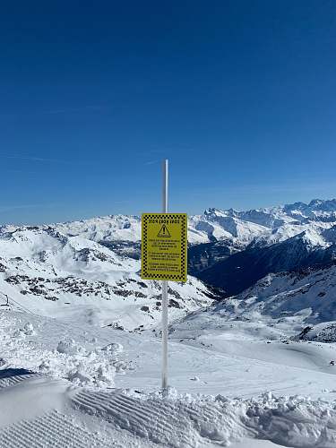
Mountain Signage: Yellow and Black Markers Against Snowy Peaks

nature typhoon weather

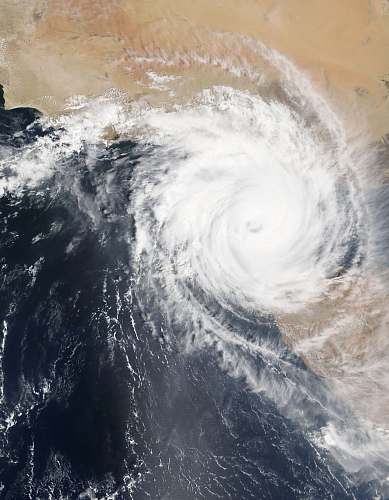
Satellite Imagery of Nature's Fury: Typhoon Impact

changsha platoon of soldier on field china

Dynamic Changsha Soldiers Standing Proudly on the Field

soil  nature

Desert Sand Dunes: A Natural Wonder

aerial photography of brown fields

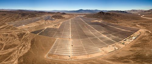
Aerial View of Desert Solar Array Surrounded by Brown Fields

bird's eye view of a lake

Aerial View of Lake and Dead Sea Landscape

Premium images by iStock

Check Also:

Blue landscape of glowing particles 1287065311

blue landscape of glowing

Abstract Hologram Landscape background 1250701147

abstract hologram landscape background

Beautiful emerald-colored glacial rivers of Iceland, taken from a helicopter 1202227531

beautiful emerald colored glacial

Abstract digital landscape background 1455004192

abstract digital landscape background

Abstract geometric landscape 832632796

abstract geometric landscape

Abs Hologram Landscape bg 1382502431

abs hologram landscape bg

Banff National Park in Alberta Canada 1134180782

banff national park in

Caribbean Sea Bathymetric Map 3D Render Neutral 1731425167

caribbean sea bathymetric map

World Map 3D Render Topographic Map Color 1092095756

world map 3d render

A lake in the shape of the world's continents in the middle of untouched nature. A metaphor for ecological travel, conservation, climate change, global warming and the fragility of nature.3d rendering 1342229191

a lake in the

Satellite view of land, war operations, sci-fi, night vision with blue hues. Military target. Drone flying over an area 1285965867

satellite view of land

3d render, abstract paper background, flat layers, relief topographic map 810076572

3d render abstract